Trail Walking Le Saix - R36 - Aujour depuis Clausonne - Photo

R36 - Aujour depuis Clausonne

Les Hautes Alpes à découvrir ! GUIDE+

© OpenStreetMap contributors
Length
Length
11.9 km
Max alt
Max alt
1813 m
Uphill gradient
Uphill gradient
770 m
Km-Effort
Km-Effort  
22 km
Min alt
Min alt
1121 m
Downhill gradient
Downhill gradient
771 m
Boucle
Boucle
Yes
Creation date :
2018-03-23 05:40:10.937
Updated on :
2018-10-17 06:32:12.2

(0 Reviews)

Walking
Walking
4h27
Difficulty : Difficult

Scan this QR Code to open this trail in the SityTrail application

FREE GPS app for hiking

Logo SityTrail SityTrail

IGN / Geographical institutes

Download SityTrail from the App Store Download SityTrail from Google Play

Logo SityTrail SityTrail World

The world is yours!

Download SityTrail from the App Store Download SityTrail from Google Play Download SityTrail on Huawei AppGallery

About

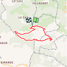
Trail Walking of 11.9 km to be discovered at Provence-Alpes-Côte d'Azur, Hautes-Alpes, Le Saix. This trail is proposed by Camping Les Rives du Lac.

Description

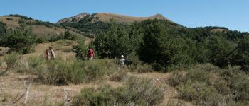
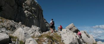
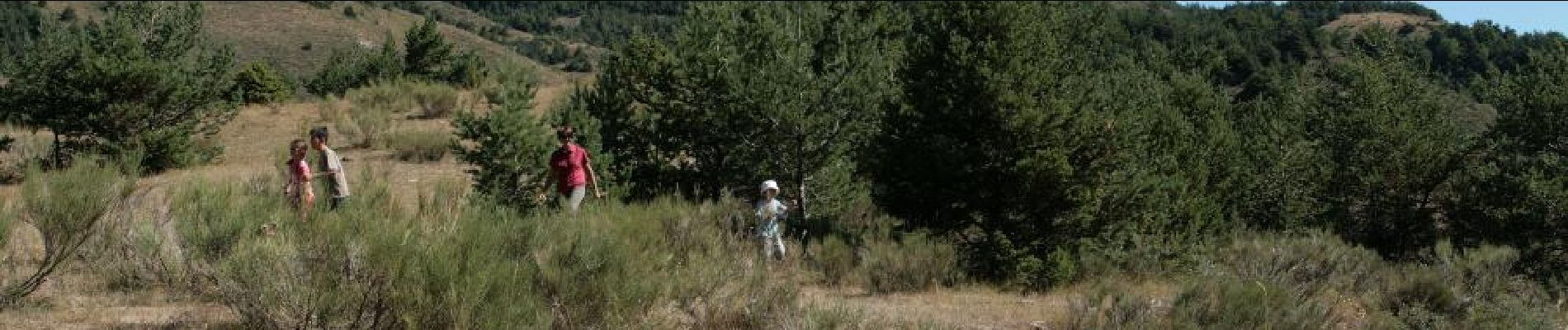
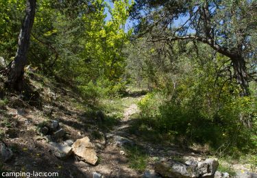
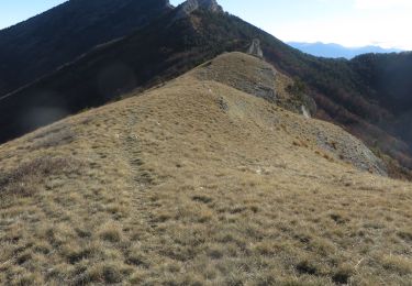
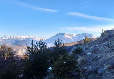
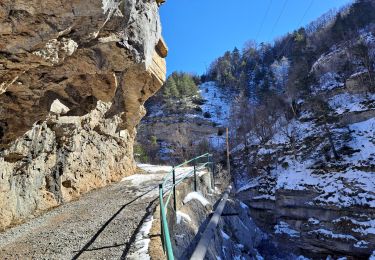
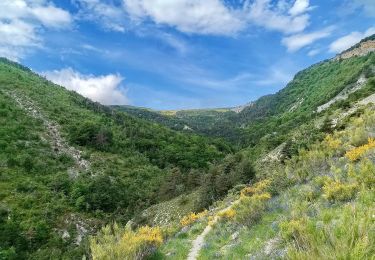
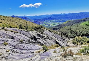
Beautiful hiking from the Abbey of Clausonne (be careful, forest road steep, narrow and with peaks, to avoid if you are not comfortable driving on this type of road). It is possible to leave the village of Saix and walk on the forest road, but this adds 300m of altitude. Attention, the upper part is not obvious to find and has some non-dangerous passages (rope to hold) but delicate. The climb is on a forest road to the collar of Armande. At the pass, take the small path that goes straight to the south. Follow him staying under the cliffs then follow the mark that allows you to cross the other side and continue to the top. Magnificent view. From the summit, continue south to begin the descent. (Passage between rocks with life line). Beautiful meadow around Lake Peyssier. In short ... To do!

Elevation profile

Photos

Points of interest

Point of interest Esparron - Lac de Peyssier - Photo
CampingLesRivesduLac
ESPARRON 
Point of interest Le Saix - Sommet d'Aujour - Photo
CampingLesRivesduLac

Positioning

Country:
France
Region :
Provence-Alpes-Côte d'Azur
Department/Province :
Hautes-Alpes
Municipality :
Le Saix
Location:
Unknown
Start:(UTM)
726213 ; 4925949 (31T) N.

Trails nearby

Trail Walking Le Saix - R08 La boucle des cascades jaunes - Photo
Walking
GUIDE+

Walking

Very easy
(1)
Le Saix, Provence-Alpes-Côte d'Azur, Hautes-Alpes, France
5.5 km | 10.3 km-effort
2h 10min
Yes
Trail Walking Le Saix - R07   le fai - Photo
Walking
GUIDE+

Walking

Easy
(4)
Le Saix, Provence-Alpes-Côte d'Azur, Hautes-Alpes, France
5.1 km | 8 km-effort
1h 42min
Yes
Trail Running Le Saix - Trail 10 - La Traversée d'Aujour - Photo
Running
GUIDE+

Running

Difficult
Le Saix, Provence-Alpes-Côte d'Azur, Hautes-Alpes, France
16.4 km | 31 km-effort
3h 0min
Yes
Trail Running Saint-Auban-d'Oze - Trail 01 - Le Cirque de Villauret - Photo
Running
GUIDE+

Running

Difficult
Saint-Auban-d'Oze, Provence-Alpes-Côte d'Azur, Hautes-Alpes, France
9.6 km | 19.9 km-effort
2h 0min
Yes
Trail Mountain bike Le Saix - VTT19 - Le tour d'Aujour - Photo
Mountain bike
GUIDE+

Mountain bike

Very difficult
Le Saix, Provence-Alpes-Côte d'Azur, Hautes-Alpes, France
24 km | 40 km-effort
2h 25min
Yes
Trail Mountain bike Le Saix - VTT18 - Col de Peyssier - Photo
Mountain bike
GUIDE+

Mountain bike

Medium
Le Saix, Provence-Alpes-Côte d'Azur, Hautes-Alpes, France
20 km | 32 km-effort
2h 15min
Yes
Trail Walking Le Saix - Lac de Peyssier - Photo
Walking
Marco05

Walking

Medium
Le Saix, Provence-Alpes-Côte d'Azur, Hautes-Alpes, France
12.8 km | 19.6 km-effort
4h 27min
Yes
Trail Walking Le Saix - Montagne d'Aujour en boucle - Photo
Walking
PapouBertrand

Walking

Very difficult
Le Saix, Provence-Alpes-Côte d'Azur, Hautes-Alpes, France
17 km | 31 km-effort
7h 14min
Yes
Trail Walking Esparron - Montagne de Rochefort via Esparron - Photo
Walking
PapouBertrand

Walking

Very difficult
Esparron, Provence-Alpes-Côte d'Azur, Hautes-Alpes, France
12.6 km | 24 km-effort
6h 12min
Yes


Close
My subscriptions